

Location:
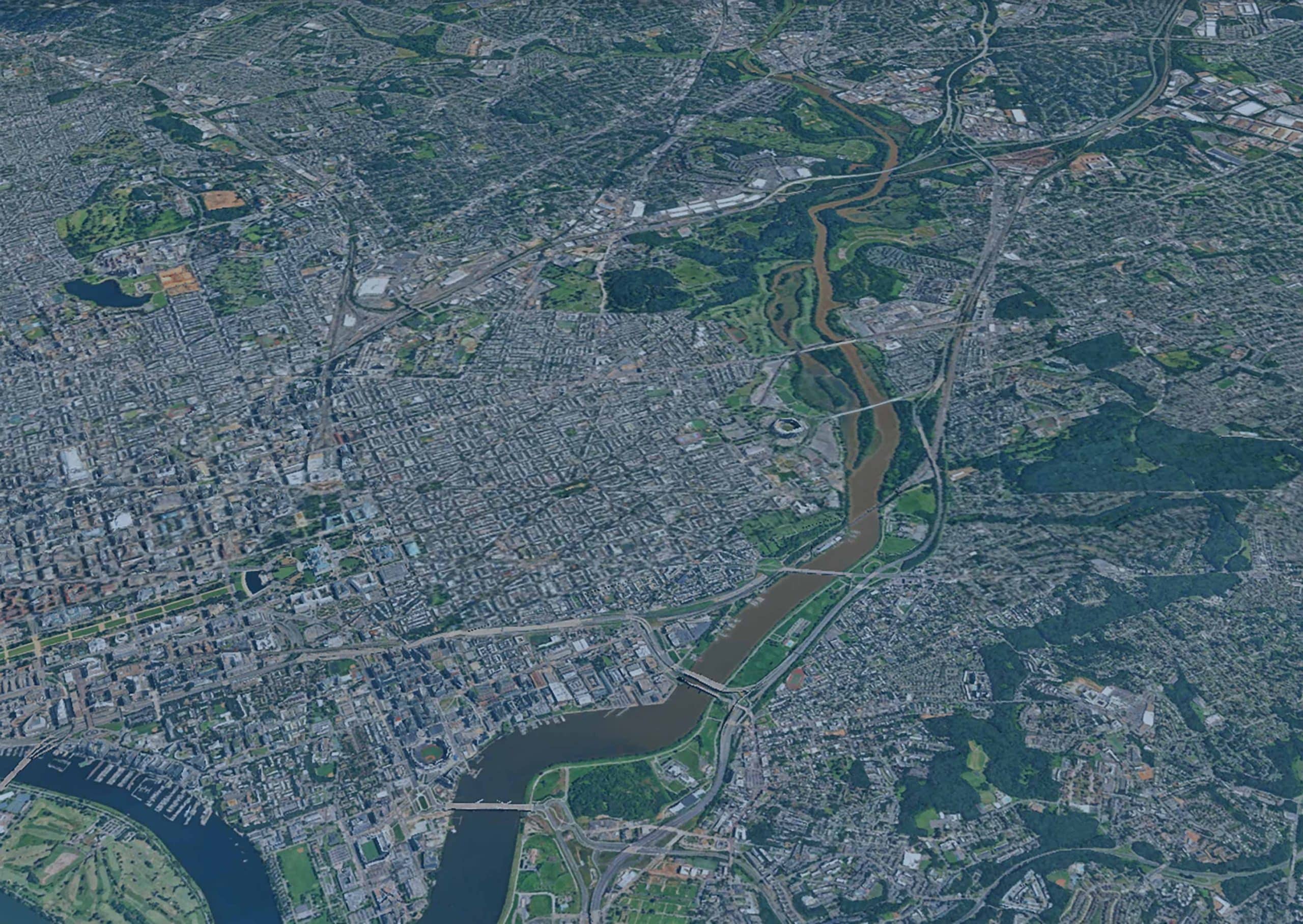
Anacostia River Corridor, Washington, DC
Client:
Department of Energy and Environment (DOEE)
Partners:
Biohabitats, NSpireGreen LLC, CHPlanning LLC, Anacostia Watershed Society
Our Expert:
LimnoTech supported the development of an integrated master plan for the restoration of the Anacostia River Corridor that addresses water quality, habitat, flood risk, climate resiliency, and public access. The plan provides the Department of Energy and Environment (DOEE) with an outline of priorities and strategies, along with comprehensive evaluations of potential projects that can be used to support grant requests for restoration implementation.
The Challenge
Over the last 300 years, the Anacostia River Corridor has been heavily degraded by river straightening, shoreline armoring, stormwater pollution, road and rail construction, dredging, and wetland destruction. Many communities in the corridor have suffered impacts from environmental degradation, separation from the riverfront, and historic inequities. DOEE needed a restoration plan that utilized a holistic approach to restore and enhance the river and included a clear roadmap with a list of priorities and strategies. This would allow the District to present a comprehensive plan to funders, instead of relying on a piecemeal strategy of individual project development and funding.
The Outcome
LimnoTech led the effort to compile and analyze spatial data for four goal areas:
- water quality
- habitat
- climate resiliency, and
- inclusive and equitable access
Our team used these data in a spatial hotspot analysis to identify areas of greater restoration opportunity within the 500-year floodplain.
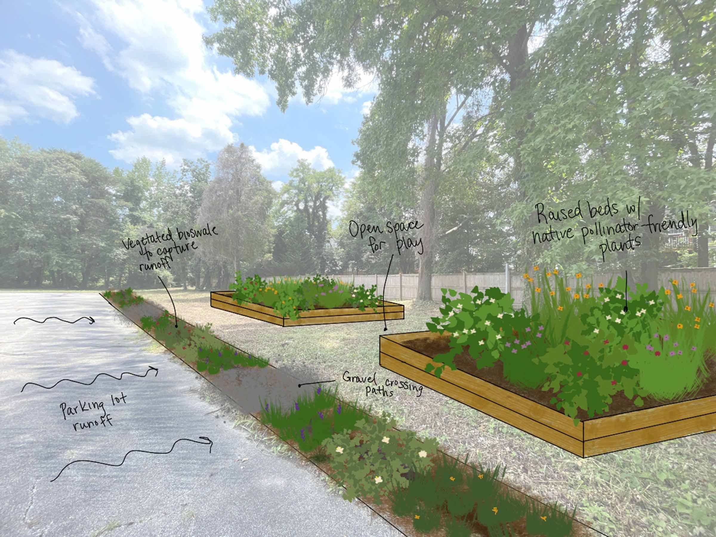
As a first step, we developed a roster of potential indicator metrics for each goal area – such as presence or absence of vegetated buffers, wetlands, or aquatic grasses; percent imperviousness; and proximity of parks or recreational opportunities. For example, if vegetated buffers were absent from a given location, that location would provide a good opportunity for the restoration of vegetation. In contrast, if the location already had a vegetated buffer area, then the opportunity for additional restoration was lower.
Based on data availability and expected utility, a subset of metrics was selected to evaluate each goal. We then compiled spatial data for the chosen metrics and developed a scoring system to differentiate the different areas. For example, the presence of flood-prone and/or heat-vulnerable infrastructure in a given location would give that location a higher score than the absence of vulnerable infrastructure.
The next step was to superimpose a grid over the corridor’s mapped landscape. The spatial datasets were then overlaid on the grid cells, and each grid cell received a score based on the data for the different metrics within that cell and the scoring rubrics. The hotspots – the higher scoring grid cells – became priority areas for targeting future restoration actions. The scoring and the metrics also provided guidance on the type of restoration that could be done in that grid cell (e.g., stormwater infrastructure upgrades, stormwater best management practices (BMPs), habitat improvements), and what goals (e.g., water quality, habitat, climate resiliency, and inclusive and equitable access) could be positively impacted by projects in that area.
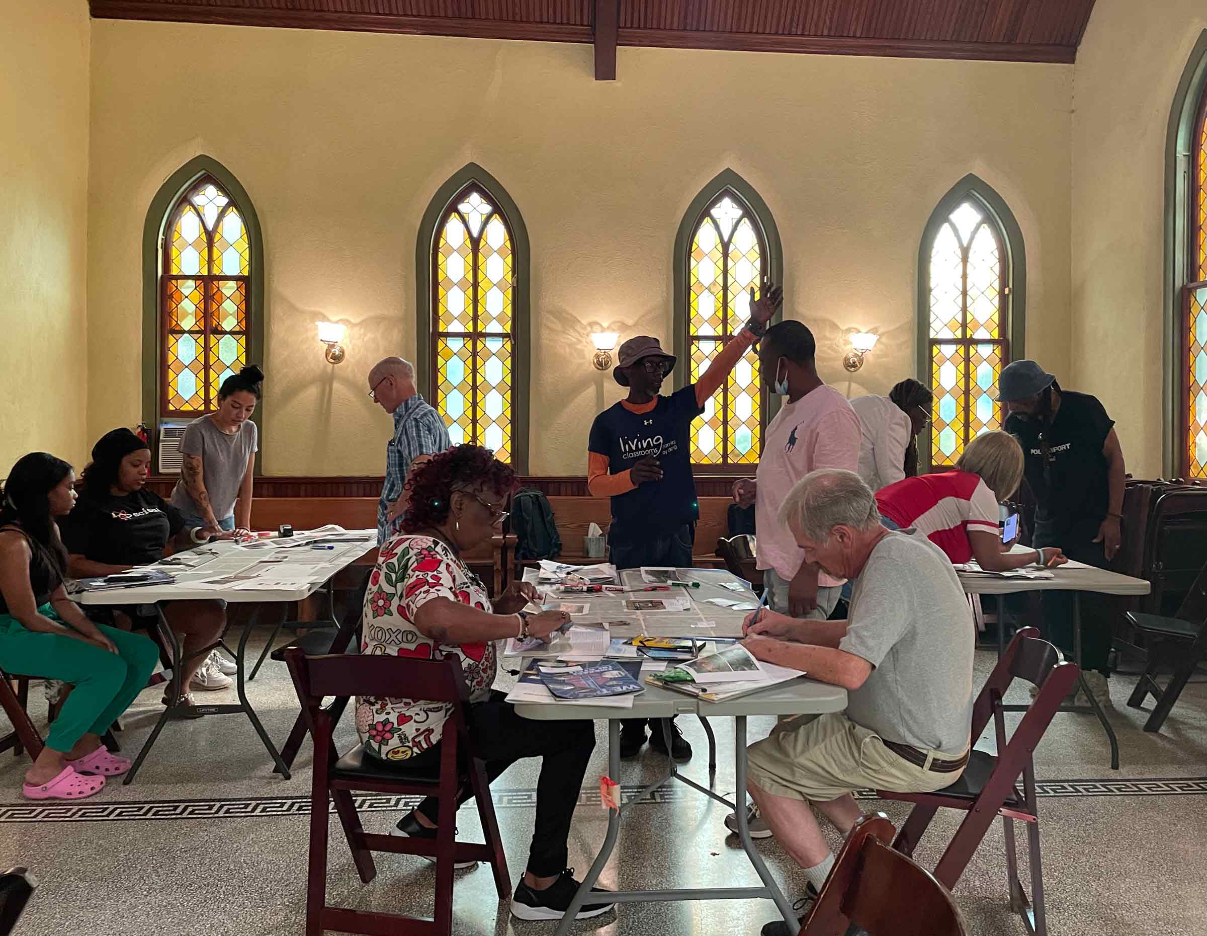
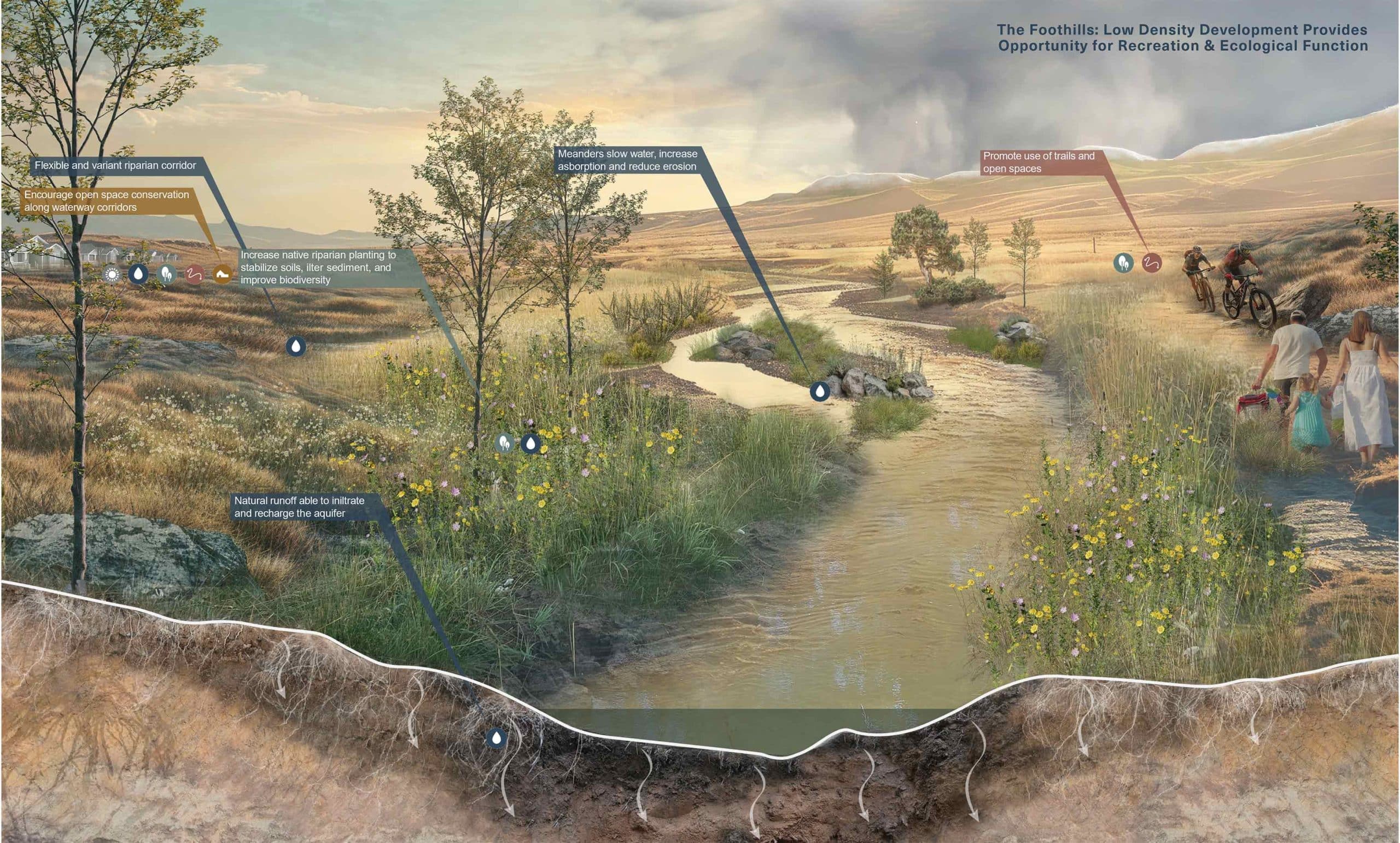
LimnoTech then constructed maps and a geodatabase to guide the next phase of the project, which included recommendations for actions to take in the high-opportunity areas. Our findings were used in a robust public engagement process to learn what stakeholders envisioned in a healthy river corridor. Solutions in the resulting plan are focused on blue-green infrastructure and nature-based landscape elements at the stream corridor, neighborhood, and site scales, and include individual proposed projects, such as stream daylighting, stormwater BMPs, wetlands to mitigate floodwaters, mussel restoration, increased pedestrian access, and green bulkhead treatments of the existing seawall, among others.
Read and download the:
Projects
-
 View Image
Read about this project: Green Infrastructure Planning & Design at the Historic Congressional Cemetery, Washington, DC
Green Infrastructure Planning & Design at the Historic Congressional Cemetery, Washington, DCClimate Change Resiliency & Adaptation Urban Ecology & Naturalization Urban Wet Weather Water Resource Investigation & Management
View Image
Read about this project: Green Infrastructure Planning & Design at the Historic Congressional Cemetery, Washington, DC
Green Infrastructure Planning & Design at the Historic Congressional Cemetery, Washington, DCClimate Change Resiliency & Adaptation Urban Ecology & Naturalization Urban Wet Weather Water Resource Investigation & Management -
View Image
Read about this project: Community-Based Organization Capacity Building Initiative for the Chesapeake Bay Trust
Community-Based Organization Capacity Building Initiative for the Chesapeake Bay TrustClimate Change Resiliency & Adaptation Urban Ecology & Naturalization Urban Wet Weather Water Resource Investigation & Management
-
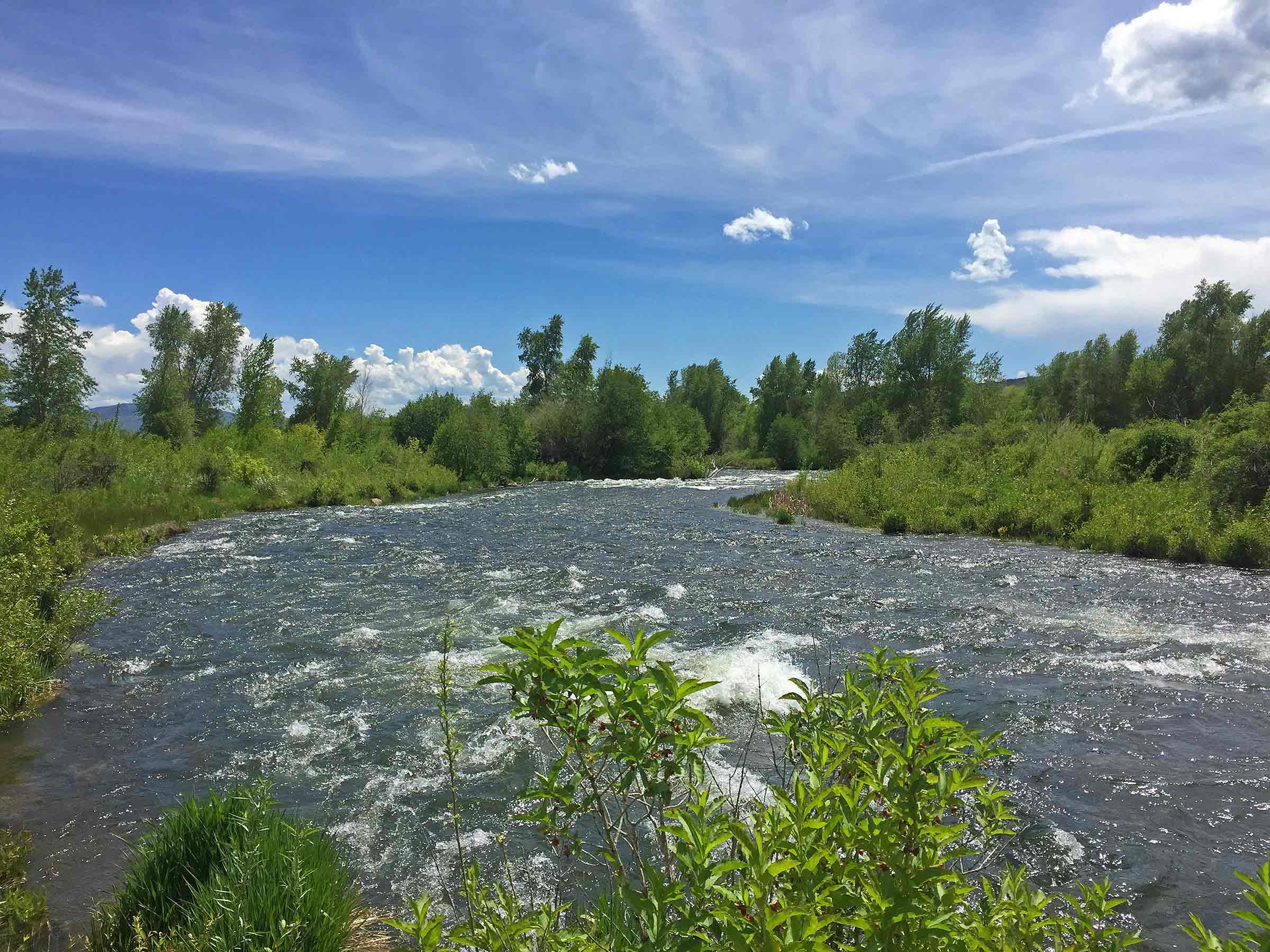
Anacostia River Corridor Restoration Plan, Washington, DCBiological/Habitat Assessment & Management Climate Change Resiliency & Adaptation Urban Wet Weather Water Resource Investigation & Management Waterway & Ecosystem Restoration
-
Great Salt Lake Stormwater Study, UtahClimate Change Resiliency & Adaptation Groundwater Supply & Remediation Urban Wet Weather Water Resource Investigation & Management Water Resources Modeling
-
Biodiversity Benefit Accounting (BioBA)Biological/Habitat Assessment & Management Climate Change Resiliency & Adaptation Sustainable Agriculture Water Resource Investigation & Management Water Stewardship
-
Water Quality Benefit Accounting (WQBA)Agricultural Environmental Services Climate Change Resiliency & Adaptation Sustainable Agriculture Water Resource Investigation & Management Water Stewardship
-
View Image
Read about this project: Programmatic and Technical Support for Coca-Cola’s Water Replenish Program
Programmatic and Technical Support for Coca-Cola’s Water Replenish ProgramAgricultural Environmental Services Climate Change Resiliency & Adaptation Environmental Data & Information Management Environmental Software Application Development Water Resource Investigation & Management Water Resources Modeling Water Stewardship Waterway & Ecosystem Restoration
-
H2Oquirrh – Southwest Waterways Visioning PlanGroundwater Supply & Remediation Urban Ecology & Naturalization Waterway & Ecosystem Restoration
-
View Image
Read about this project: Upper Wolf Creek and Ottawa-Stony Watershed Management Plans, Michigan
Upper Wolf Creek and Ottawa-Stony Watershed Management Plans, MichiganAgricultural Environmental Services Water Quality Monitoring Water Resource Investigation & Management Water Resources Modeling
-
View Image
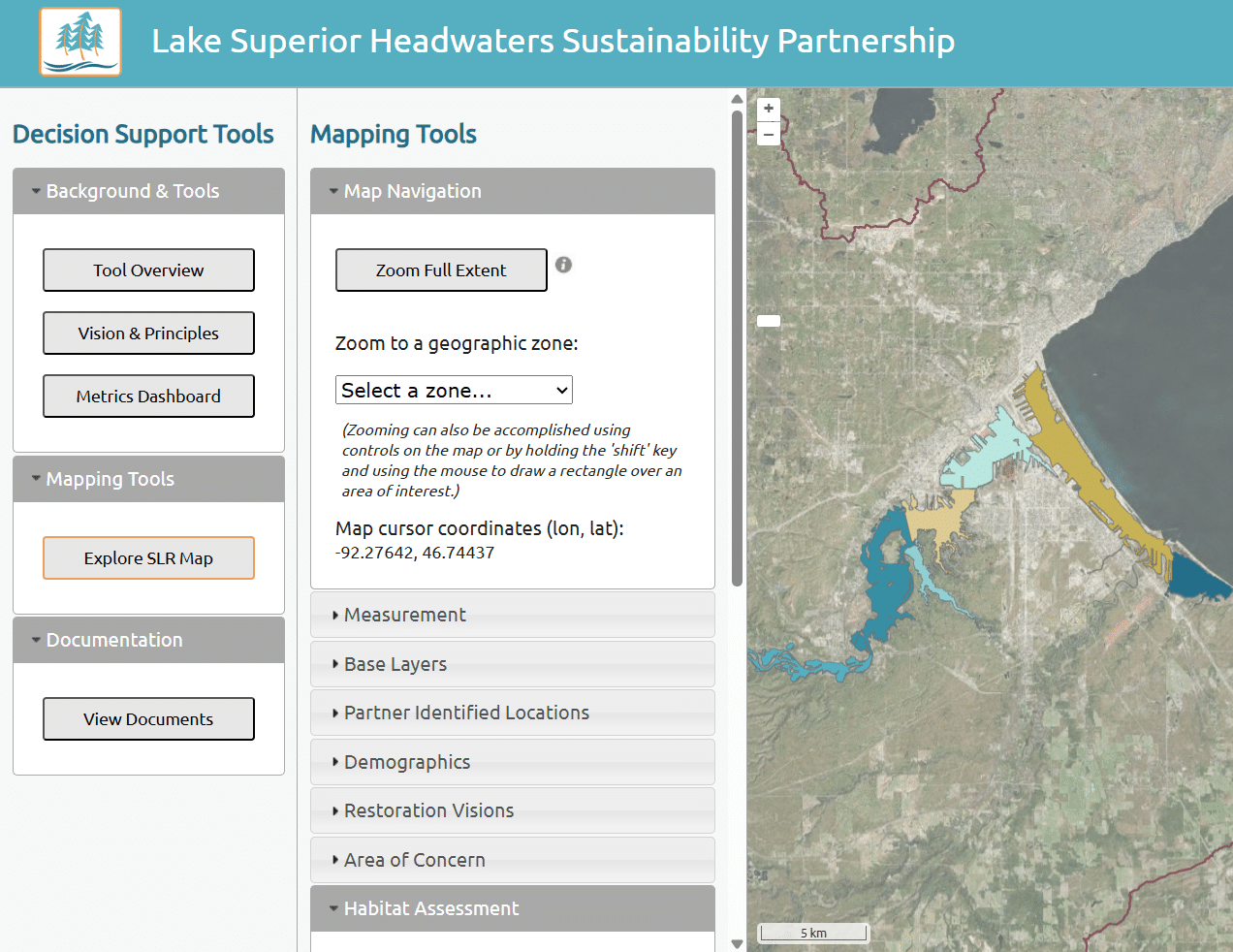
Read about this project: Lake Superior Headwaters Sustainability Partnership Decision Support Tool
Lake Superior Headwaters Sustainability Partnership Decision Support ToolClimate Change Resiliency & Adaptation Environmental Data & Information Management Environmental Software Application Development Water Resource Investigation & Management Waterway & Ecosystem Restoration